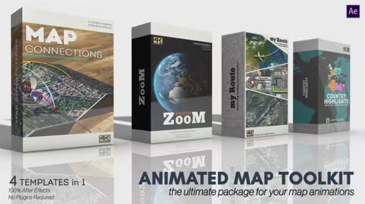
Videohive Animated Map Toolkit
| Program Name | Version | Resolution | Add-Ons | File Size |
|---|---|---|---|---|
| After Effects | CC + | 3840x2160 | NO Plugins | 490 Mb |
Videohive – Animated Map Toolkit – 30616266 – Free Download After Effects Template
Animated Map toolkit is a compete suite made by 4 articulated templates to create your custom map animation.
All projects were made in 4K to guarantee the maximum video quality.
No plugins required, just your After Effects application (from cc2018 to above) and everything will be easy thanks to exhaustive video tutorials and an efficient customer support.
Let’s start with the first product: Map Connections!
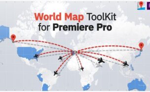
Map Connections allows you to add and create unlimited points and connections.
It is very useful to show correlations between 2 or more places, or to show the stages of a journey.
What you need to do is just import your map image, place your points of interest and configure the connections, simply by typing the name of the start and ending points in a text field; the template will automatically create and place the connection to link the points.
Of course you can integrate your animation with pins and call-outs, all these elements adapt their position interactively according to the map fold, so you’re free to change the map fold amount when you want, without having to adjust everything from scratch.
What about the camera animation?
Moving a camera with keyframes, especially for beginners, could be a very difficult task. For this reason, a new camera animation system has been built to facilitate this job.
So you can control the camera simply by adding layer markers! For example, if you want to reach a point called “Building” in 3 seconds, you just need to create a marker at 3 sec and name it “Building”. The camera will smoothly move to reach the “Building” point.
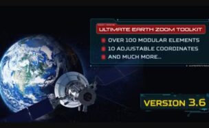
Earth Zoom is one of the most used animations to show the position of a place in the world and reach it with a fast zoom.
Earth Zoom requires “Google Earth Pro”, an application that you can download for free and that must be used to manually collect 6 maps to import into the project.
(Attention: the maps are not automatically downloaded by the template, this task must be manually done by the user. All instructions are well explained in the tutorial).
What you need is to take note of each map altitude and type it in a corresponding text field. The template will analyze these infos and it will calculate and place them in the correct position.
The template is subdivided in 2 main animations: The first one is “Map Zoom”: it can be used to create a simple zoom without showing the full globe. Furthermore you can:
- adjust the start and end camera altitude
- set the camera speed
- set the clouds amount
- choose whether to rotate the camera during the zoom or not and add a camera shake effect
- add pins and call-outs on your arrival point
The second animation is “Earth Zoom”, the ideal solution to create a versatile and professional animation starting from a very far camera position to have a full view of the Terrestrial Globe The animation includes several options to adjust the appearance of the Earth animation accordingly to your needs.
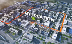
My Route, inspired by Map Route Generator, contains all required tools to create a smooth path animation.
Just import your map image, draw your path and play the animation!
Now if you want to add stop points, simply add markers in the correct time position and set the stop duration.
You can insert pins and call-outs, adjust several graphical parameters like the line thickness, color, shadow, use one of the available trackers or use your custom one, change the floor, the background and much more…
Finally you can choose one of the following camera animations:
- Follow tracker: in this mode the tracker will be always at the center of the shot
- Rotate around tracker: like the previous mode but with a rotation around the tracker
- Manual mode: here you’re free to adjust the camera position as you prefer, so you can keep the camera still, or move it creating your own keyframes.
In mode 1 and mode 2 you can also set the camera altitude and the distance from the tracker. If you want you can also animate these parameters adding keyframes.
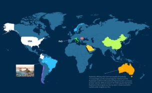
The final product is Country Highlights. It is made by a project and a script, where you just need to type the name of the countries that you want to highlight, choose the reveal IN and OUT mode and the highlight effect and color. With this tool you can easily highlight a ton of countries in a while!
Animated Map Toolkit also includes 55 customizable elements: Pins, call-outs, and image Call-outs that you can use in your animations.
Music not included, if you like it you can buy it from: https://audiojungle.net/item/uplifting-inspirational-corporate/26027870